Day 2-Montana
We left Sheridan,Wyoming and headed to Rosebud Battlefield State Park which is the site of a Plains Indian War battle a few days before the Little Bighorn that resulted in a stalemate after several hours of fierce fighting and caused Gen. Crook to retire back to Sheridan to resupply and rest his troops. The tough opposition from Cheyenne and Sioux warriors caused him to be cautious and unwilling to move out without further reinforcements and thus he was not there to assist at the Battle of the Little Bighorn.
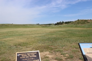
It’s also known by the Cheyenne as the battle where the girl saved her brother. Buffalo Calf Road Woman saw her brother’s horse shot out from underneath him and in a hail of bullets, she rode into the battle and her brother climbed onto the horse behind her. They rode to safety and she later fought beside her husband at the Little Bighorn.
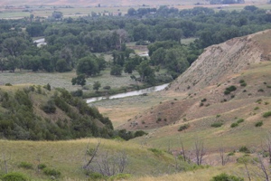
Rosebud is off the beaten path and we drove into the backcountry to get to it. We passed an interesting dugout and saw isolated farmsteads along Rosebud Creek. It was very beautiful back there and fascinating to see some of the “real” Montana. Next we headed to Little Bighorn and it’s a site that’s been on my life list for a long time so it was fun to finally see it.
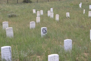
I had studied up in the car about the battle so had a good overview and as we hiked the various trails I was again impressed by the terrain and the ground. It’s surprisingly undulating ground, so groups of warriors had ample places to gather for attacks and protection for guerrilla-type warfare. Custer’s “Last Stand” took place on a hill along a ridge and once we saw the ground and walked down in the low area below it and looked up, it was easy to imagine how it all ended for those members of the 7th Cavalry.
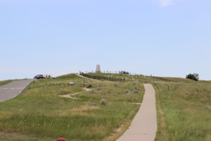
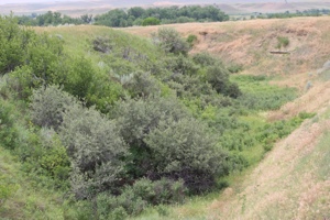
The same with the Deep Ravine area where 28 troopers were killed in a low, tight area easy for the warriors to fire down on them.
We also hiked around the Reno-Benteen battle area four miles away which is part of the park and includes the fighting that took place the day before and same day as the more famous Custer fight. Reno’s men crossed the river into the huge warrior encampment but were driven back across the Little Bighorn and retreated up to a high area where they made a successful stand and survived to travel over to the Custer battle area the next day and bury the bodies.
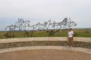
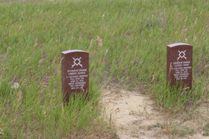
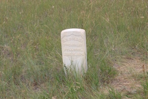
In the early 1990’s the name of the park was changed from Custer Battlefield to Little Bighorn and attention was changed from Custer to both sides of the conflict. A Spirit Memorial was built to help the spirits of the soldiers and warriors find peace and red markers were placed around the battlefield where accounts showed that native warriors had fallen. These are in addition to the white 7th Cavalry markers that had been there for many years.
We really enjoyed our trip to Little Bighorn and gained a respect for and understanding of the events.

 Day One- Wyoming
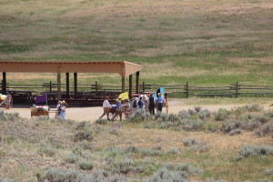
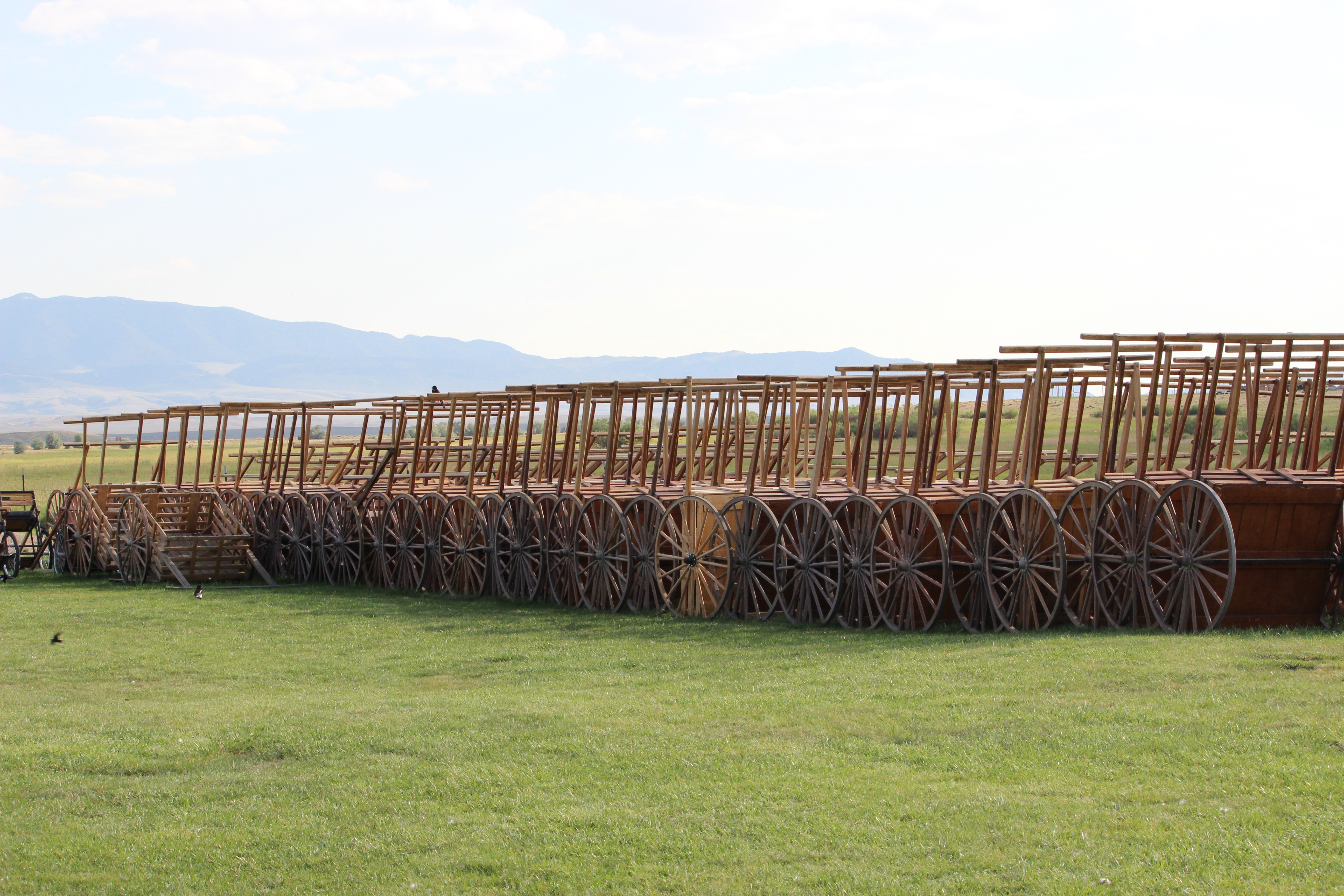
 We passed several groups of youth Trekkers on the trail and got a feel for the boys’ teenage experience here with our neighborhood group. The Mormon visitor center is at the Sun Ranch by Devil’s Gate and the Martin Company moved from there to the cove in a heavy snowstorm with over a foot of snow on the ground in an attempt to shelter themselves somewhat from the storm and wait it out. I found the actual area much different from what I imagined from the accounts. This is why geography is so important to historians. I can read and imagine but whenever I get out on the actual ground of an historical event I am always surprised at how much my understanding of the event increases. When looking at the terrain from different vantage points it usually becomes obvious why the people made the choices they did and how the ground affected those choices. The original accounts called the sheltered area “Martin’s Ravine” and the name was later changed to Cove; I don’t know why.
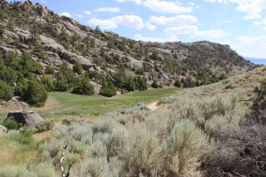 But it is totally a U-shaped ravine and they camped in the curved section which is at the far end of the ravine. When I saw it in person it made sense why they attempted the move, which was described as difficult and the members of the company unwilling due to the sub-zero temperatures, their exhaustion, and lack of rations for days. The rescuers encouraged them to do it, knowing their survival depended on it. The visit to the actual cove was profoundly moving and I’m very glad we went.
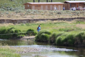
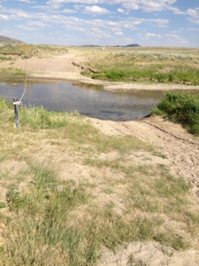 We hiked down from the cove and moved out along the sand trail by the Sweetwater River. It was slow going through the soft sand and my tennis shoes have a mesh top, so every step put sand into my shoes. By the time we reached the visitor center, all the loose area around my toes was filled with sand and they couldn’t wiggle. As we were slogging along this sand trail I made the observation to Scott that this was an interesting experience to actually be out on the prairie on foot. When you’re driving the interstate you can look around and see the vast expanses of the west and marvel at how big it is. But you cover a lot of ground at 70 mph and there are few places to get out and really walk, as there are fences lining the interstate and any walking areas are short trails along the road. We were out on the prairie and had been walking for a long time and when we looked around and it didn’t seem like we had gone very far in that big open space. I really got a sense of how far it must have been to walk 15 miles in a day and look back to see the same panorama and feel like you weren’t making much progress in that vast land. It was a moving experience I had not expected to have.