Day 4-Montana & Canada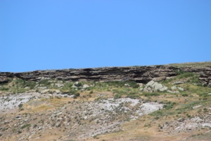 We went to First People’s Buffalo Jump State Park and it was more developed than Madison. There was a new visitor’s center with really nice displays and stuff for kids. We were treated to a personal introductory talk by one of the rangers, who explained about jumps and how they were used. They had three taxidermied bison, one of which you could touch and she reassured us that none of them were wild but all from ranches. They also had a wolf skin that kids were allowed to put on for photos. I offered to take a pix of Scott with it on but he declined.
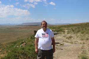 There was a walking trail to the top along the front face or a driving road around the side that went to the top of the bluff. I was getting tired so to conserve some energy for later, we opted for the road. At the top were some displays and a ginormous prairie dog town, much larger in area than the state park we had been to the previous day. It turns out that bison and prairie dogs live together well because the bison graze and trample the short grass making it easier for the dogs to see farther for predators and they also like to take dust baths in the mounds to protect themselves from bugs. The prairie dogs eat annual plants, thus encouraging the growth of perennials like buffalo grass and blue grama that the bison like to eat. Who knew? I thought the bison would just break their legs stepping in burrow holes, but apparently they are smarter than me.
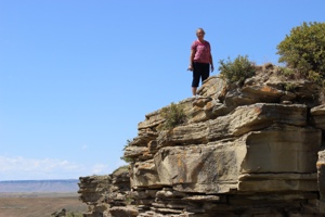 During the “dog days” before the tribes had horses, this jump was used for harvesting buffalo by stampeding them to the edge so they fell over a cliff before they had time to realize and stop. Several herds of 75-100 animals grazed on top of this huge bluff and the buffalo runner focused on one herd. He was a teenage boy dressed in a calf skin who spent a couple days with the herd to identify the lead cow. If he could draw her towards the edge, the others would follow and his two teen mates in wolf skins lurked in the back of the herd to keep them moving to the edge. He dived over the cliff to a prearranged safe ledge or crevice where he hid as the herd thundered over to their deaths. Adult warriors also hid along the drive route to ensure the entire herd went over. Warriors at the bottom killed any animals still living and the women and children immediately began processing the animals’ meat, hide, bones, hooves, and organs, as the entire animal was used. The young buffalo runner became a man at once for his daring deed to help the tribe.
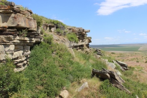 We loved the immense view from the top. We could see in all directions for miles and miles. I guess that’s why they call it Big Sky Country.
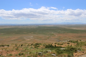
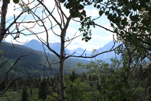
We left there and drove to the border where I got to use my very first passport as we entered Canada. We stopped to take pictures of Waterton in the distance.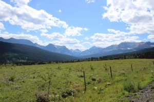
 Our destination was Cardston, in Southern Alberta, to visit Brian who is appearing for the summer at the Carriage House Theatre. We met him at the theatre for a quick behind-the-scenes tour, grabbed dinner during his call time, then saw the first show. It was called “Encore” and is performed three times during the summer by the full-time summer cast. They performed some group numbers from the summer plays and did some solo and small-group numbers in a showcase-type format, interspersed with short video clips of funny interviews of the cast members. Brian accompanied several numbers on the piano, including a Disney mash-up that he arranged that gave solo moments to each cast member, as well as three intermingled duets that included him singing while playing. It was awesome! The whole show was great with some fantastic talent and very fun to see.
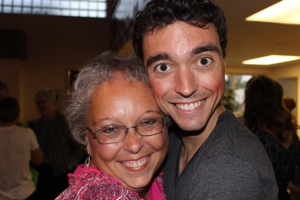
Pictograph State Park
Day 2 continued
After leaving Little Bighorn we continued our quest to see more state parks. Rosebud earlier that day was unmanned so we put our $5 in an envelope and slid it in a box. Then discussed how this was going to break us if we paid five bucks at every little waystop state park. But we moved on from Little Bighorn to Pictograph State Park. This had a small visitor center with a real person where we saw a sign for a non-resident annual pass to the state parks. Scott did some quick mental math because he’s just good like that, and figured it was a worthwhile deal because we had several parks in the pipeline. That was quite the experience for the summer help. Apparently non-residents do not purchase Montana State Park annual passes. Ever. (At later stops with rangers we had to assure them repeatedly that we had a sticker on our car window. Fortunately, most rangers turned out to be trusting souls, although one was unaware the state even offered such a thing. So fun to be a complete anomaly. Later in the trip I took a picture of the sticker with my phone for proof.)
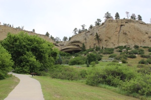
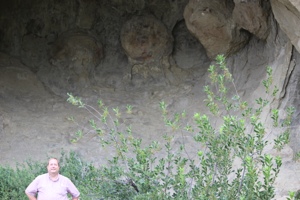
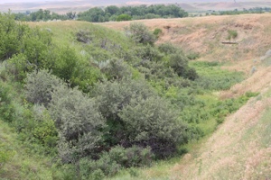
Armed with our new pass, we hiked the short, but steep trail to the cave. There was a sign up saying to be careful because a rattlesnake had been seen on the trail earlier in the day. Scott’s response: Cool! Another lady’s response: No way am I going up there! Being brave adventurers, we started up. That couple did not. Soon we saw them following us escorted by the ranger with a snake-catching pincer-thing. So we got free patter in the cave. Score!
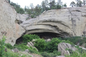
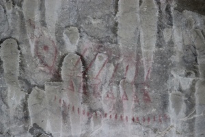
The cave was fascinating. It had red and black drawings on the walls, but the black ones are harder to see because there is seepage on the back wall which dries white and obscures the drawings. He said they are much easier to see when the cave is wet because the walls are dark.
We then hiked over to the Ghost Cave and got a glamour shot of me in a secluded shade area which was pretty and only lasted for a few feet, but was a nice break from the heat.
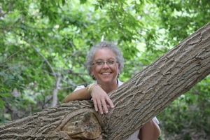
Ghost Cave had a series of concretions, which are snowball-like rock growths over ancient clam shells. Photos of Scott with geologic formations whenever possible as he endures my historical forays with good grace.
Little Bighorn Battlefield
Day 2-Montana
We left Sheridan,Wyoming and headed to Rosebud Battlefield State Park which is the site of a Plains Indian War battle a few days before the Little Bighorn that resulted in a stalemate after several hours of fierce fighting and caused Gen. Crook to retire back to Sheridan to resupply and rest his troops. The tough opposition from Cheyenne and Sioux warriors caused him to be cautious and unwilling to move out without further reinforcements and thus he was not there to assist at the Battle of the Little Bighorn.
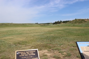
It’s also known by the Cheyenne as the battle where the girl saved her brother. Buffalo Calf Road Woman saw her brother’s horse shot out from underneath him and in a hail of bullets, she rode into the battle and her brother climbed onto the horse behind her. They rode to safety and she later fought beside her husband at the Little Bighorn.
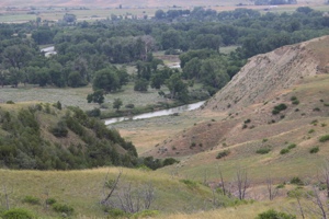
Rosebud is off the beaten path and we drove into the backcountry to get to it. We passed an interesting dugout and saw isolated farmsteads along Rosebud Creek. It was very beautiful back there and fascinating to see some of the “real” Montana. Next we headed to Little Bighorn and it’s a site that’s been on my life list for a long time so it was fun to finally see it.
I had studied up in the car about the battle so had a good overview and as we hiked the various trails I was again impressed by the terrain and the ground. It’s surprisingly undulating ground, so groups of warriors had ample places to gather for attacks and protection for guerrilla-type warfare. Custer’s “Last Stand” took place on a hill along a ridge and once we saw the ground and walked down in the low area below it and looked up, it was easy to imagine how it all ended for those members of the 7th Cavalry.
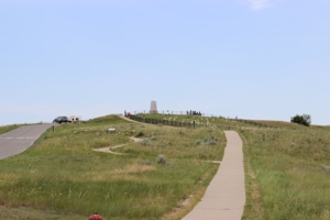
The same with the Deep Ravine area where 28 troopers were killed in a low, tight area easy for the warriors to fire down on them.
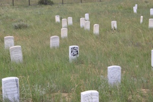
We also hiked around the Reno-Benteen battle area four miles away which is part of the park and includes the fighting that took place the day before and same day as the more famous Custer fight. Reno’s men crossed the river into the huge warrior encampment but were driven back across the Little Bighorn and retreated up to a high area where they made a successful stand and survived to travel over to the Custer battle area the next day and bury the bodies.
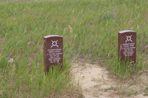
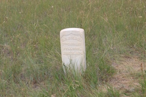
In the early 1990’s the name of the park was changed from Custer Battlefield to Little Bighorn and attention was changed from Custer to both sides of the conflict. A Spirit Memorial was built to help the spirits of the soldiers and warriors find peace and red markers were placed around the battlefield where accounts showed that native warriors had fallen. These are in addition to the white 7th Cavalry markers that had been there for many years.
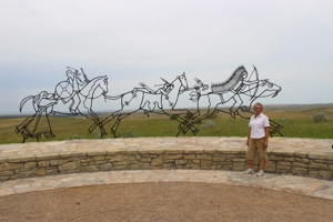
We really enjoyed our trip to Little Bighorn and gained a respect for and understanding of the events.
Martin’s Cove

 Day One- Wyoming
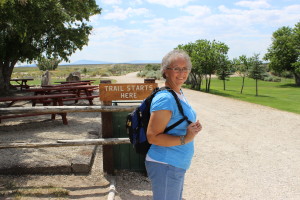
We have always wanted to see Martin’s Cove and finally were able to include it in a trip. I read some history of the handcart company to Scott on the drive there so he was up to speed on the history. We assumed we would have to do some walking but didn’t do our homework beforehand and discovered on arrival that the hike to the cove is a 5.2 mile round trip on a very hot day. We loaded the backpack with water bottles and set out, confident that we could do it. We did, of course, but we were hot and sweaty by the end.
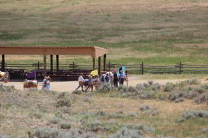
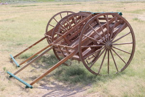 We passed several groups of youth Trekkers on the trail and got a feel for the boys’ teenage experience here with our neighborhood group. The Mormon visitor center is at the Sun Ranch by Devil’s Gate and the Martin Company moved from there to the cove in a heavy snowstorm with over a foot of snow on the ground in an attempt to shelter themselves somewhat from the storm and wait it out. I found the actual area much different from what I imagined from the accounts. This is why geography is so important to historians. I can read and imagine but whenever I get out on the actual ground of an historical event I am always surprised at how much my understanding of the event increases. When looking at the terrain from different vantage points it usually becomes obvious why the people made the choices they did and how the ground affected those choices. The original accounts called the sheltered area “Martin’s Ravine” and the name was later changed to Cove; I don’t know why.
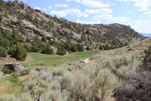 But it is totally a U-shaped ravine and they camped in the curved section which is at the far end of the ravine. When I saw it in person it made sense why they attempted the move, which was described as difficult and the members of the company unwilling due to the sub-zero temperatures, their exhaustion, and lack of rations for days. The rescuers encouraged them to do it, knowing their survival depended on it. The visit to the actual cove was profoundly moving and I’m very glad we went.
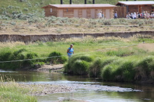 The Sweetwater River meanders and loops back on itself all and the pioneers crossed it many times in the journey west. The Martin Company had to cross it in the snow with ice chunks in the water in their move to the Cove. The river is not deep but it’s wide.
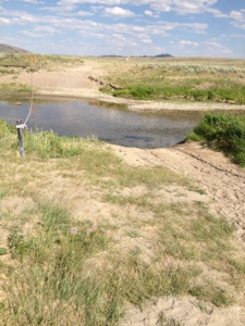 We hiked down from the cove and moved out along the sand trail by the Sweetwater River. It was slow going through the soft sand and my tennis shoes have a mesh top, so every step put sand into my shoes. By the time we reached the visitor center, all the loose area around my toes was filled with sand and they couldn’t wiggle. As we were slogging along this sand trail I made the observation to Scott that this was an interesting experience to actually be out on the prairie on foot. When you’re driving the interstate you can look around and see the vast expanses of the west and marvel at how big it is. But you cover a lot of ground at 70 mph and there are few places to get out and really walk, as there are fences lining the interstate and any walking areas are short trails along the road. We were out on the prairie and had been walking for a long time and when we looked around and it didn’t seem like we had gone very far in that big open space. I really got a sense of how far it must have been to walk 15 miles in a day and look back to see the same panorama and feel like you weren’t making much progress in that vast land. It was a moving experience I had not expected to have.
Since we had been there all afternoon we didn’t spend much time in the center with our long drive ahead, and we felt pretty grounded in the history. But it’s a very nice center with tour guides and interpretative displays. We drove up the road a few miles to Independence Rock and walked 3/4 of the way around as were pretty tired and hot. We only saw a couple signatures so I was disappointed as I know I’ve seen photos of many all together. So either they are on the area we didn’t get to or they are eroded.
Hello, July!
So happy to have June 2013 in the rear view mirror. Mark endured a personal tragedy that affected all of us and caused a lot of grieving. Then last week my father suffered a stroke and has been in the ICU since Tuesday. I’ve spent many hours each day helping him be comfortable and working on rehab exercises. He was on a ventilator and is now breathing on his own, but still can’t swallow so he has a feeding tube. He is being transferred to the rehab unit of the hospital today to start working intensely on getting more use of his left side. It has been a very traumatic month.
So I’m looking forward to a new month plus we’re introducing a new design to the website. And in case you didn’t know, this month is:
National Blueberry Month
National Anti-Boredom Month
National Cell Phone Courtesy Month
National Hot Dog Month
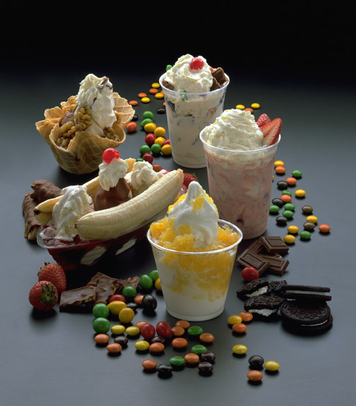
National Ice Cream Month
And July 1 is Canada Day, Creative Ice Cream Flavors Day, and International Joke Day. So have some ice cream while playing a joke on someone and singing “O Canada”!
Live it up!
[suesig/]